

 by
by This post is from several unrelated spots around the Delmarva Peninsula over the last year, including one stop that has been too heartbreaking to look at.
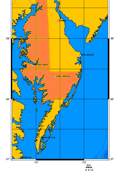
The Delmarva Peninsula is that dangle of land dropping underneath New Jersey. Its name is comprised of the first letters of Delaware-Maryland-Virginia, all of which have land on the peninsula. It is 170 miles long and 70 miles wide at its widest. On the west and southwest it is bordered by the Chesapeake Bay and Pocomoke Sound; the Atlantic Ocean, Delaware River, and Delaware Bay are on the east coast.
The accompanying image is from the Wikipedia page explaining the peninsula, since an image is better than my explanation.
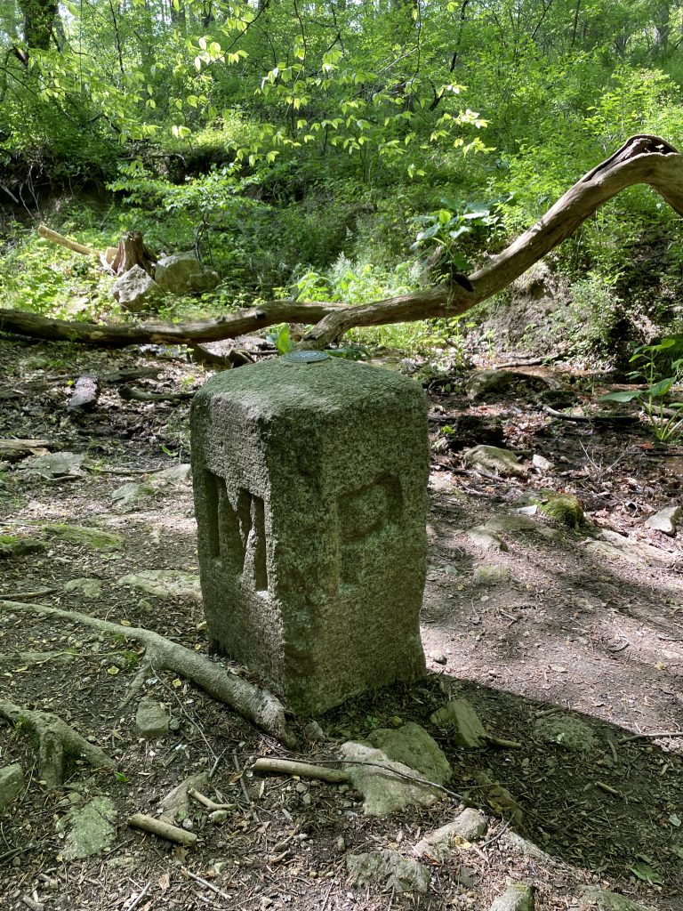
Last May we stopped at White Clay Creek State Park in Delaware in order to hike over to the Delaware-Maryland-Pennsylvania Tri-State Point, marked by a stone placed in 1849. We had a nice hike to the spot on a lovely spring day, getting to stand in three states at once.
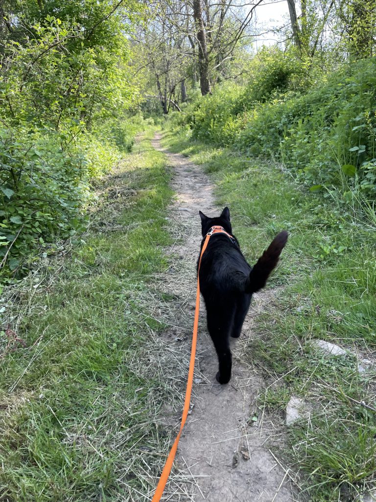
Afterwards, I took Mr. K for a trail walk, and he was all in, charging ahead. Little did I know at the time it would be his last van adventure. I can barely stand to look at the pictures even now, We miss him beyond words.

In honor of President Biden’s home state of Delaware I read Andrew Shaffer’s book Hope Never Dies (affiliate link). Given great sense of humors and legit bromance, I really thought this book would be a fun romp. Sadly, it earned the lowest number of stars from me.
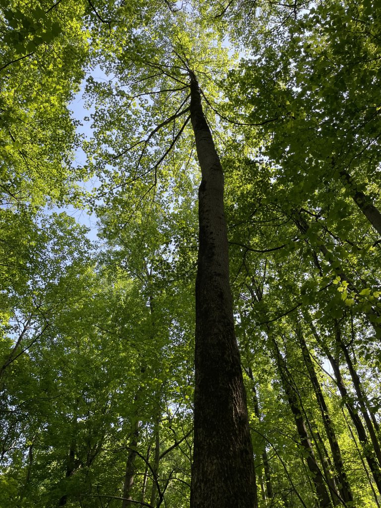
Another photo from our hike to the Delaware-Maryland-Pennsylvania Tri-State Point. I love beautiful and healthy trees! The cover photo is also from this hike.
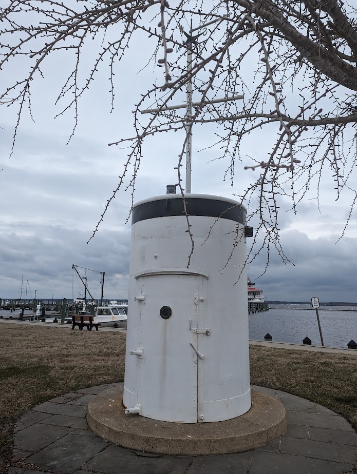
President Franklin D. Roosevelt went through great lengths to hide his disability. On his presidential yacht, the USS Potomac, a smokestack hid an elevator so he could move between decks in his wheelchair. It is now a memorial at Long Wharf Park in Cambridge, MD.
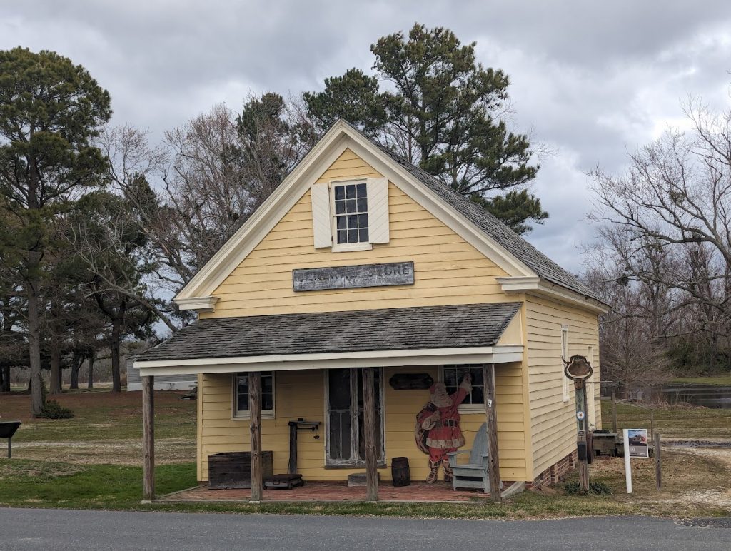

The Harriet Tubman Underground Railroad National Historical Park near Cambridge, Md., honors Harriet Tubman (c 1822 – 1913), who escaped slavery, then returned again and again to the South help others do the same. There are no artifacts on display, it’s mostly just signboards to read and a movie to watch. The building is just generally in the vicinity of where she lived, “worked”, and returned, so it’s not a very moving experience, to be honest. The yellow building pictured is the Bucktown General Store, where Harriet was inadvertently struck in the head by a two-pound weight, giving her seizures and sudden sleeping spells for the rest of her life (which makes what she did all the more remarkable); it was not open during our visit. We listened to a short audiobook about Harriet’s remarkable life while driving around the area; Harriet Tubman: Conductor on the Underground Railroad was written by Ann Petry, the mother of a late friend of ours.
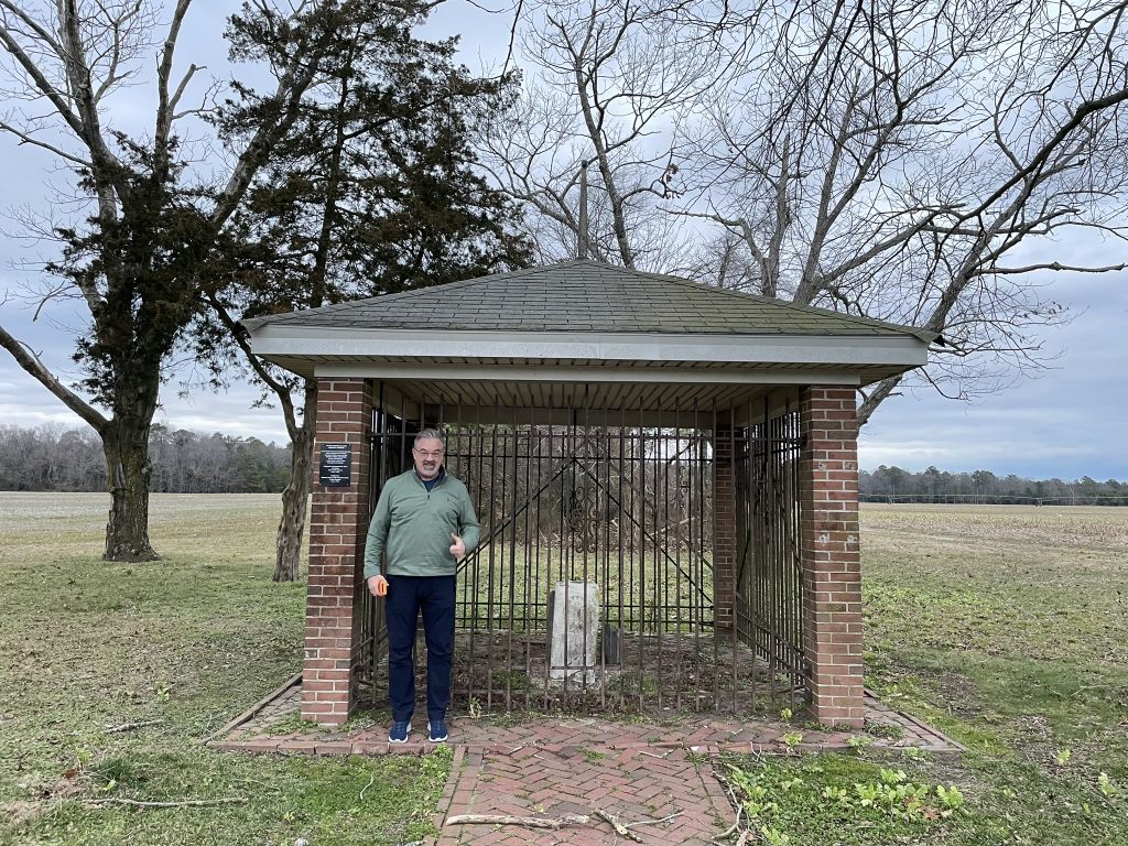
I earned Good Girlfriend Points taking Doug to the Transpeninsular Midpoint Marker in Delmar, Md. I think its clear to everyone that Transpeninsular Midpoint Marker is fun to say, but is it fun to visit? You can see from the picture that Doug, at least, was very pleased with the visit.
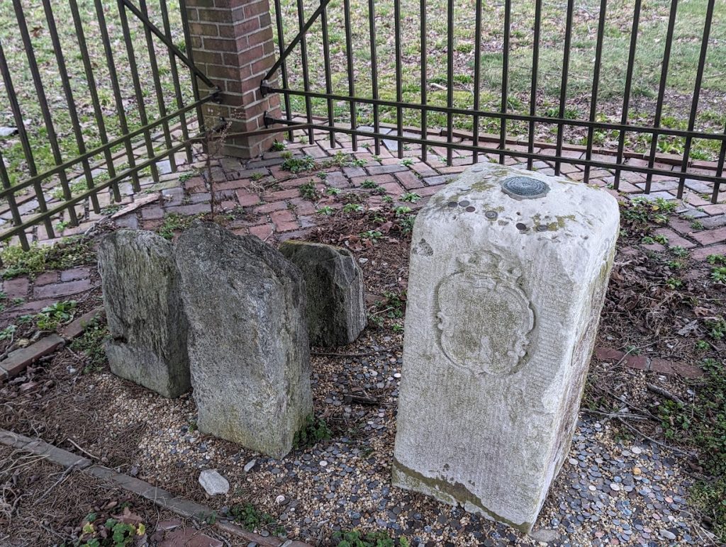
The markers were put in place when Lord Baltimore and William Penn received charters to form colonies back in the day – but their land claims overlapped by a fair amount, and they weren’t the only ones it happened to. After much legal to-do, professionals were brought in to settle the affair in 1763: Charles Mason and Jeremiah Dixon. Mason & Dixon walked the Maryland-Delaware border over the next four years, placing a stone marker each mile. The southern-most point of the Maryland-Delaware border is what is marked here; it’s also the eastern end of the Mason-Dixon line, which later came to be known as the informal boundary marking the North from the South.


